基于GIS/RS的西疇縣土地利用結構分析
2017-07-13 05:23:57王艷艷李向新李陶
安徽農業科學
2017年13期
王艷艷 李向新 李陶

摘要 采用西疇縣土地調查數據,通過GIS/RS相關理論和技術對西疇縣土地利用結構及影響因素進行分析,從而揭示西疇縣土地利用結構現狀,總結了土地利用結構的特點,并提出了相應建議,從而指導土地結構的調整。
關鍵詞 土地利用結構;GIS/RS;西疇縣
中圖分類號 F301.2 文獻標識碼 A 文章編號 0517-6611(2017)13-0192-03
Analysis on the Land Use Structure of Xichou County Based on GIS/RS
WANG Yan-yan,LI Xiang-xin, LI Tao
(Faculty of Land Resource Engineering,Kunming University of Science and Technology, Kunming, Yunnan 650093)
Abstract Using land survey data of Xichou County and GIS/RS related theory and technology, land use structure and influence factors of Xichou County were analyzed, so as to realize the present situation of land use structure in Xichou County. The characteristics of land use structure were summaried, and some suggestions were put forward, in order to guide adjustment of the land structure.
Key words Land use structure;GIS/RS;Xichou County
土地資源是人類生存、社會發展不可替代的物質基礎和支撐,也是人類棲息的基地和基本衣食來源。了解土地利用結構狀況,確定土地利用結構是否合理,不斷改善土地利用結構,對于科學指導土地決策與土地利用活動將發揮越來越大的作用[1]。
西疇縣位于云南省東南部,地勢北部和中部高,東南、西南低,境內山巒起伏,地形復雜。全縣國土面積1 506 km2,東接麻栗坡縣,西南與馬關縣毗鄰,北與文山、硯山、廣南縣接壤。全縣轄7鄉2鎮69個村民委員會3個社區1 778個村民小組,住有漢、壯、苗、瑤、彝、蒙古等民族。境內有平船路、西路直通文山和國家級口岸船頭及廣西西寧,基本形成了以省道為主體,縣鄉道為依托,村寨道為輔助的交通公路網絡[2]。筆者采用西疇縣土地調查數據,通過GIS/RS相關理論和技術對西疇縣土地利用結構及影響因素進行分析,揭示西疇縣土地利用現狀,并提出了相應建議,從而指導土地結構的調整。
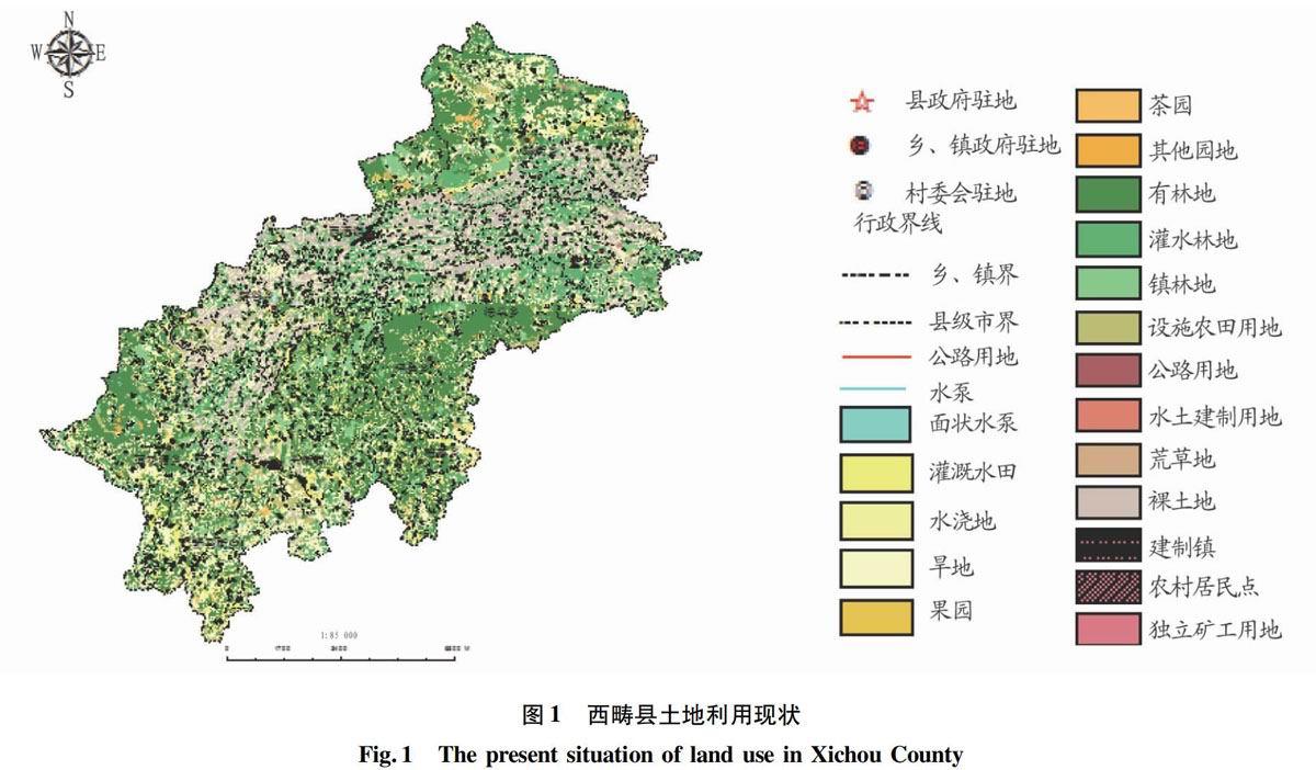
1 土地利用現狀
1.1 土地利用結構概況
根據全國土地調查,西疇縣土地總面積為1 491.30 km2,土地利用現狀見圖1。土地面積中,農用地(耕地、園地、林地、其他土地)1 397.50 hm2,建設用地(農村居民點、工礦用地、建制鎮)40.05 hm2,其他用地53.75 hm2。……
登錄APP查看全文
