隴中黃土丘陵區農村居民地空間分布特征及發展策略——以天水市為例
2024-10-23 00:00:00陳玉玲
安徽農業科學
2024年19期
摘要 以甘肅省天水市為例,應用GIS空間分析和統計分析方法對農村居民地空間分布特征進行了定量分析,并提出了發展對策與建議。結果表明:全市農村居民地與高程、坡度、坡向、年平均氣溫、平均年降水量、河流等自然條件在空間分布特征顯著,存在一定的梯度分布特征,與公路、河流呈明顯帶條狀分布,全市農村居民地整體空間分布分散、聚集性差。該研究結果可為天水市鄉村振興工作提供參考。
關鍵詞 農村居民地;空間分布;發展策略;天水市
中圖分類號 TU982.29 文獻標識碼 A 文章編號 0517-6611(2024)19-0182-07
doi:10.3969/j.issn.0517-6611.2024.19.039
開放科學(資源服務)標識碼(OSID):
The Spatial Distribution Characteristics and Development Strategies of Rural Residential Land in the Loess Hilly Region of Central Gansu—Taking Tianshui City as an Example
CHEN Yu-ling
(Gansu Forestry Voctech University, Tianshui, Gansu 741020)
Abstract This article took the Tianshui area of Gansu Province as an example,applied GIS spatial analysis and statistical analysis methods to quantitatively analyze the spatial distribution characteristics of rural residential areas,and proposed development strategy suggestions. The results showed that the spatial distribution characteristics of rural residential areas in the city were significant in relation to natural conditions such as elevation,slope,aspect,annual average temperature,average annual rainfall and rivers.There was a certain gradient distribution characteristic and a clear strip like distribution with highways and rivers.The overall spatial distribution of rural residential areas in the city was scattered,with poor clustering.The research results could provide reference for the rural revitalization work in Tianshui area.
Key words Rural residential land;Spatial distribution;Development strategy;Tianshui City
基金項目 2022年甘肅省教育科技創新項目(2022A-257)。
作者簡介 陳玉玲(1976—),女,甘肅會寧人,副教授,從事資源環境教研工作。
收稿日期 2024-02-15
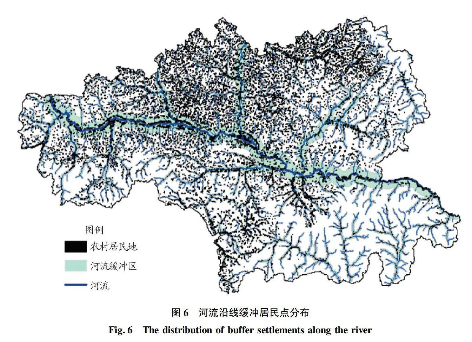
2004—2023年,我國連續20年頒布“三農”主題的中央一號文件。黨的十九大報告提出“鄉村振興戰略”,黨的二十大報告更提出“全面推進鄉村振興,堅持農業農村優先發展”。建設宜居宜業的美麗鄉村,實現廣大農民的中國夢,一直是鄉村振興的研究熱點。我國地大物博,氣候類型多,地形復雜,在鄉村振興的新征程上,聚焦破解鄉村發展困局,不同學者從不同領域提出了發展策略,其中研究村落空間分布對鄉村發展的影響十分重要。胡燕等[1]基于GIS將村落分布特征分為團狀、帶狀和分散等類型,顯示出居民點分布沿河流、公路特征顯著;李云強等[2]基于GIS技術結合Voronoi圖,提出了區域村落分布特征和優化策略。
隴中黃土丘陵溝壑區地形破碎、自然條件差,農村居民點分散,經濟落后,多數村莊長期處于貧困狀態,是各級政府扶貧的重點對象,美麗鄉村建設難度高。……
登錄APP查看全文