基于哨兵2號數據的撂荒地識別與分析——以甘肅省麥積區為例
2024-12-03 00:00:00王瑞君楊斌斌呂志鵬
安徽農業科學
2024年22期
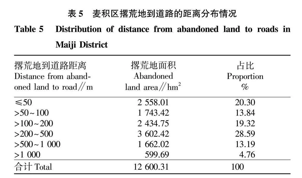

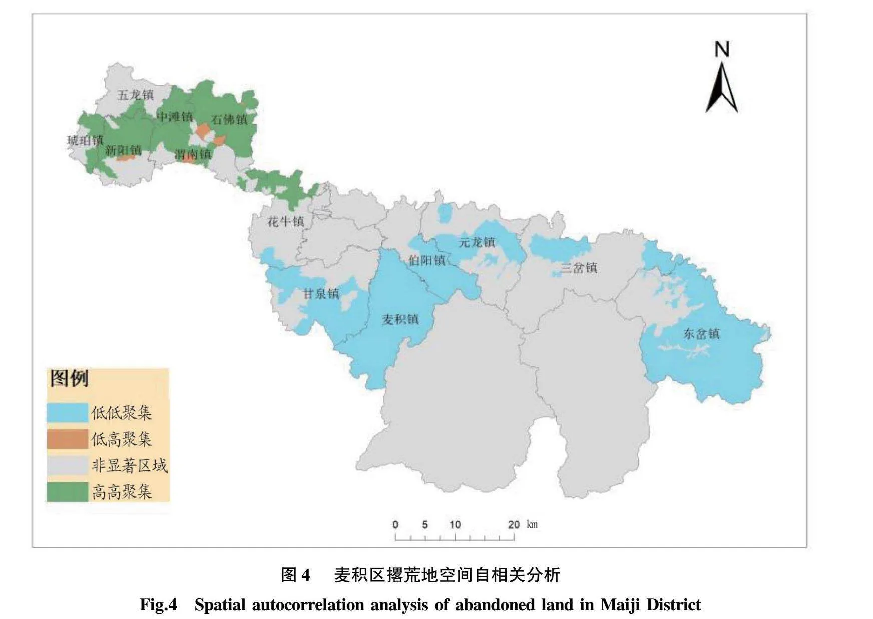
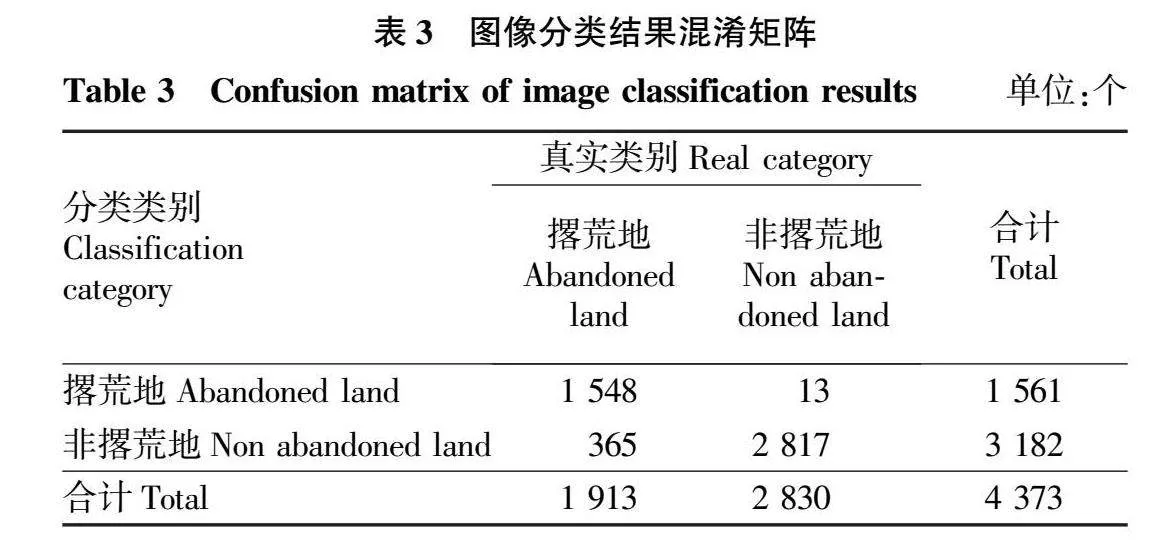
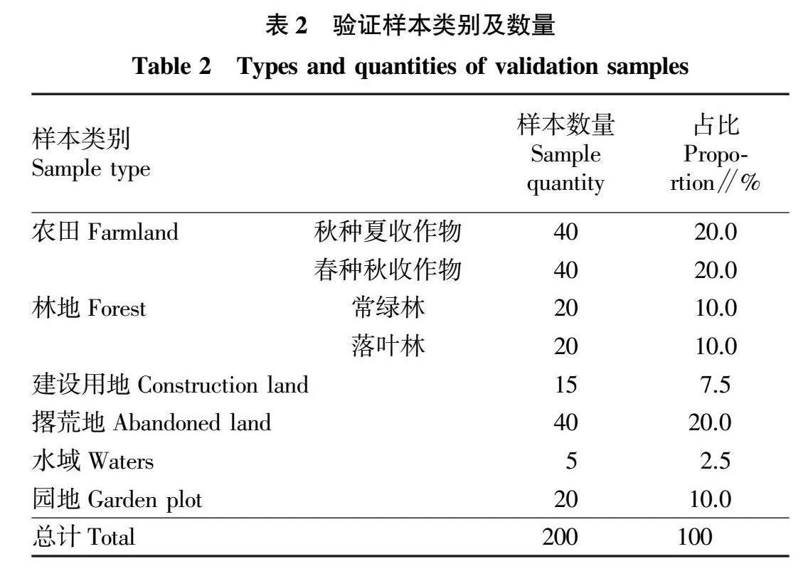


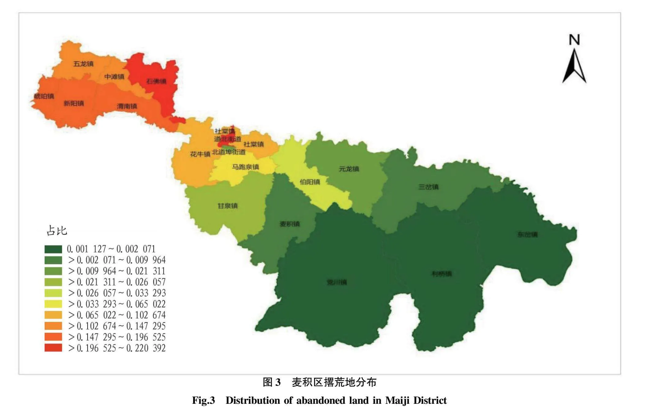
摘要 以甘肅省麥積區為研究區域,采用哨兵2號遙感衛星數據,并基于面向對象的方法對該區域的撂荒地進行了識別,分類總體精度達到92%,Kappa系數為0.82。空間統計結果顯示,麥積區的撂荒地面積為12 600.31 hm2,占麥積區總面積的3.62%,占耕地總面積的22.02%。坡度分析和交通條件分析發現,地形因素和交通條件是導致撂荒的重要原因。對麥積區的撂荒地進行空間自相關分析發現,撂荒地存在顯著的空間集聚特征。
關鍵詞 撂荒地;哨兵2號;面向對象圖像分類;空間自相關
中圖分類號 S 127 文獻標識碼 A
文章編號 0517-6611(2024)22-0070-05
doi:10.3969/j.issn.0517-6611.2024.22.013
開放科學(資源服務)標識碼(OSID):
Identification and Analysis of Abandoned Land Based on Sentinel-2 Data—A Case Study of Maiji District, Gansu Province
WANG Rui-jun, YANG Bin-bin,L Zhi-peng
(Gansu Forestry Polytechnic,Tianshui,Gansu 741020)
Abstract Taking Maiji District in Gansu Province as the research area, object-oriented method was used to identify abandoned land based on Sentinel-2 remote sensing satellite data,the overall classification accuracy reached 92%, and the Kappa coefficient was 0.82.The spatial statistical results showed that the abandoned land area in Maiji District was 12 600.31 hm2, accounting for 3.62% of the total area of Maiji District and 22.02% of the total cultivated land area.Slope analysis and traffic condition analysis found that terrain factors and traffic conditions were important reasons for abandonment.A spatial autocorrelation analysis of abandoned land in Maiji District revealed significant spatial clustering characteristics.
Key words Abandoned land;Sentinel-2;Object-oriented image classification;Spatial autocorrelation
隨著城鎮化和工業化的迅速發展,非農就業收入和機會的增加使得大部分農村勞動力轉移到其他行業,導致耕地撂荒現象日益嚴重。耕地撂荒不僅導致土地資源的浪費,還會造成土壤質量下降,加劇水土流失和土地荒漠化。此外,耕地撂荒導致的農產品產量下降還會造成食品短缺和食品安全問題。因此,采取有效措施防止耕地撂荒至關重要,而要做到這一點,首要任務就是有效識別和監測耕地撂荒情況。
近年來,隨著遙感技術的不斷發展,利用遙感識別耕地撂荒已經成為可能。如肖國峰等[1]使用Landsat數據和HJ1A數據,并采用CART決策樹分類方法,制定了撂荒地的識別規則,監測了1992—2017年山東省慶云縣和無棣縣的撂荒地,結果顯示最大撂荒率為5.37%;劉智麗[2]利用2017—2019年不同季節的哨兵2號遙感影像數據監測了山西省祁縣耕地變化,并采用面向對象分類方法識別撂荒耕地,該方法提取撂荒地的總體精度為86.3%;……
登錄APP查看全文
