大數據驅動的人居環境提升
2021-04-19 00:53:22鄭曦
風景園林 2021年1期
冬至日是年末最重要的節氣,開始“提冬數九”,直到“九九”春暖花開,周而復始。二十四節氣是古人通過經年累月的觀察與記錄總結的傳統經驗,同樣的歷史數據還包括對星象、氣溫、洪水、物候等的詳細記載,通過這些數據發現物換星移、四時之變的規律,數據的收集與分析促進了古人對自然規律的認知和生產生活方式的塑造。
當今數據的收集方式產生了變革,認知的速度也呈幾何級數增加。大數據逐漸成為日常生活的一部分,隨著社交媒體的爆炸式發展,我們每個人日常行為軌跡都成為了數據源,例如手機信令數據、微博大數據、公交刷卡大數據等。這些數據的數據量大,處理過程復雜,公眾成為參與收集、分類、記錄或分析數據的主體。大數據所帶來的改變是全領域的,也是顛覆性的。依靠專業的數據分析來解決規劃設計問題,是對傳統意義上規劃設計與分析框架的補充,但是面對復雜的海量數據,如何處理并合理使用數據也成為當前人居環境規劃設計實踐的主要挑戰。
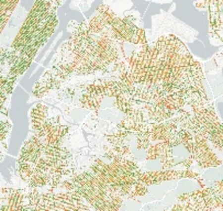
在大數據技術革命的新環境下,用于支撐規劃設計分析的大數據,可以更及時、精確地找到問題所在,為優化方案的運行方式提供一定科學依據。數據能否真正“增強”設計呢?很多學者結合最新的科學與技術,開展了探索性研究與實踐。多源數據的出現在很大程度上提升了設計師對不同尺度場地的識別能力,設計師可以通過大數據獲得在地調研之外的更豐富和更大尺度的空間信息,例如土地利用、大范圍人群的景觀感知等,這些都對規劃設計起到重要的輔助支撐作用,展現出大數據輔助規劃設計的強勁態勢。宏觀層面上,聚焦于新型城鎮化背景下城市群綠色空間的統籌規劃、綠道體系規劃以及大中尺度的自然保護地規劃等內容,通過對共享衛星遙感數據、土地利用資料、氣象數據等空間、時間層面的原始數據進行轉換處理,得到清晰明確、重點突出的可視化信息,進一步提出應對城市災害風險、緩解城市生態壓力的景觀系統。微觀層面上,大數據在設計中的應用更多體現在利用手機信令數據、街景數據以及公交刷卡數據等多種類型的移動信息對不同人口需求做出不同的響應,提出針對性的設計對策,并廣泛應用在具體實踐中。
但大數據并不是萬能的,首先表現在數據精度與研究空間尺度的匹配問題上,例如口袋花園是居民日常休閑的重要場所,但是由于信號基站分布范圍遠大于口袋花園的分布范圍,設計師很難通過手機信令數據準確判斷口袋花園的游憩行為;其次,大數據內容與研究內容較難直接匹配,數據僅僅表現為單一的分布特征,其邏輯遠達不到規劃設計的復合特征要求,如何讓數據服務設計,實現“增強”設計是重要的研究方向。
與人居環境直接相關的自然環境與歷史數據均可成為“增強”設計的大數據類型,客觀認知大數據、合理使用大數據是學科發展的重要途徑。只有不斷提高對大數據專業化應用的理解力和洞察力,讓數據服務助力設計師更敏銳地感知和體驗人居環境的變化與特質,提出基于大數據分析的創造性解決方案,引導未來人居環境與未來生活的新形態和新場景才是根本目的。

Living Environment Improvement Driven by Big Data
The day of Winter Solstice is the most important solar term at the end of year. Starting from “the 1st nine-day-period entering winter” until “the 9th nine-day-period” indicating spring blossoms, the cycle always repeats itself. The twenty-four solar terms are traditional experiences summarized from ancient years’ observations and records. The similar historical data also include detailed records of astrology, temperatures, floods, phenology, etc. Through these data, it is possible to identify the laws of changes of nature and stars as well as the shifts of seasons. In a word, the collection and analysis of data promoted the ancient people to recognize natural laws and shape their styles of production and life.
With innovation in the ways of data collection today, the speed of cognition has also been boosted exponentially. Big data have gradually become a part of daily life. With the explosive development of social media, the daily behavior trajectories of each of us have become data sources, for example, mobile phone signaling data, social media big data, bus card big data and the like. The massive data entails complex processing procedures. And the public has become the subject to participate in the collection, classification, recording or data analysis. The changes brought about by big data are all-inclusive and disruptive. Relying on professional data analytic to address planning and design problems is a supplement to the traditional framework of planning, design and analysis. Nevertheless, in the face of complex and massive data, how to process and reasonably use data has also become a major challenge in current research, planning and design practices by the disciplines related to living environment.
Under the new environment of big-data technology revolution, the big data used to support the planning and design analyses can pinpoint problems in a more timely and accurate manner, while providing a scientific basis for optimizing the operation of solutions. Can data really “enhance” the design? In combination of the latest science and technology achievement, many scholars have implemented exploratory research and practice, showcasing the strong momentum of big-data assisted planning and design. The emergence of multi-source data has greatly boosted designers’ ability to identify the sites of different scales, because they are able to, via big data, acquire richer and larger-scale spatial information beyond on-site surveys, such as information on land use, the landscape perception of a large range of people, etc. All these methods play an important supporting role for planning and design. At the macro level, it focuses on the overall green space planning of urban agglomeration, greenway system planning and nature reserve planning in large and mediumsize under the background of new urbanization. Through the conversion and processing of spatial and temporal raw data such as shared satellite remote sensing data, land use data and meteorological data, clear and focused visualized information can be obtained, which can be used for reference while further putting forward the landscape system to deal with the urban disaster risk and relieve the urban ecological pressure. At the micro level, the application of big data in the design is more reflected in the use of mobile phone signaling data, street view data, bus card data and other types of mobile information to make various responses to the needs of different populations, to further put forward targeted design countermeasures, which could be widely used in specific practice.
However, big data are not a panacea. First of all, there is an issue of matching between the data accuracy and the space scale of research. For example, pocket garden is an important place for local residents’ daily leisure. However, because the signal base stations are distributed much more widely than the range of pocket garden, it is difficult for designers to accurately determine the recreational behavior around pocket garden via mobile phone signaling data. Secondly, it is uneasy to directly match the big-data contents and research contents, and the data could only demonstrate a single distribution feature, with its logic far from meeting the requirements of composite features of planning and design. It is still an important research field that how to enable the data to serve designs and realize “enhanced” designs.
Both the natural environment data and historical data directly related to living environment can become a big data type that can “enhance” designs. It is an important way for the discipline’s development to objectively recognize and rationally use big data. By continuously improve the understanding of and insight into the professional applications of big data, driving data services help planners more keenly perceive and experience the changes and characteristics of living environment, putting forward creative solutions based on big data analysis, and guiding new forms and new scenes of future living environment and future life are the fundamental purposes.
Editor-in-Chief: Professor ZHENG Xi
December 25, 2020
猜你喜歡
中老年保健(2021年12期)2021-08-24 03:30:40
中國傳媒大學學報(自然科學版)(2021年1期)2021-06-09 08:43:00
現代裝飾(2020年7期)2020-07-27 01:27:42
流行色(2020年1期)2020-04-28 11:16:38
中國生殖健康(2020年6期)2020-02-01 06:28:50
新世紀智能(英語備考)(2019年12期)2020-01-13 06:07:18
中國生殖健康(2019年11期)2019-01-07 01:28:02
中國生殖健康(2018年6期)2018-11-06 07:09:28
藝術啟蒙(2018年7期)2018-08-23 09:14:18
海峽姐妹(2017年7期)2017-07-31 19:08:17
